The Chattooga River was designated by Congress in 1974 to be Wild and Scenic.
What does this mean? A river that earns designation as a National Wild and Scenic River becomes protected against development along its banks or in the river, must be free-flowing (no dams), has limitations on the size of trips going down at any one time for numbers of boats, and times between trip launches (for example only 7 rafts per trip, launched an hour apart), among other things.
The Chattooga is protected into perpetuity and is under the jurisdiction of the US Forest Service. There are just three outfitters permitted to operate on the Chattooga: Wildwater, Nantahala Outdoor Center and Southeastern Expeditions.
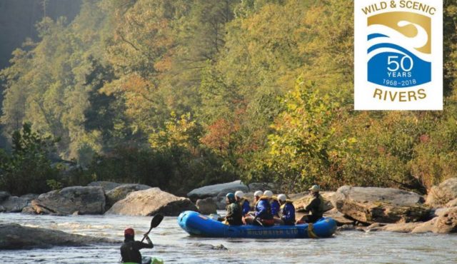 Excerpt from article written by Becky Wise, who’s father founded Wildwater Ltd. rafting company:
“The Chattooga River is the only National Wild and Scenic River in Georgia and South Carolina. It is a prized natural resource flowing from northeast to southwest through a protected wilderness corridor for 59 miles along the Georgia/South Carolina border in the southern Appalachian Mountains.
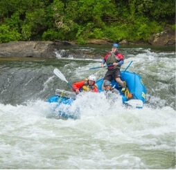
The Chattooga River is legendary for its intense rapids and rugged scenery and abounds with untouched wilderness, incredible sights as the gorge walls rise above you, and exciting rapids full of drops and whitewater!”
There is a 1/4 mile boundary on each side where there can be no construction, no roads, no motor vehicles or other man-made structures.
There are two roadways that cross the river, Highway 76 from South Carolina into Georgia; and Highway 28 from South Carolina into North Carolina. On the Georgia side of the river, Rabun County officials wanted to appease their local constituents and allowed existing access points into the river to remain open. Cars can drive into Earls Ford and Sandy Ford on the Georgia side.
For rafting guests, recreational paddlers, anglers, hikers, swimmers, etc., the 1/4 mile buffer means that all boats, gear, coolers and necessities must be hauled to and from the river. The reward of having this buffer is the wonderfully wild and scenic time on the river visitors experience!
There are four sections of the Chattooga River:
Section I mostly flat water great for fishing
Section II starts from Hwy. 28 – Earls Ford, good for canoeing and kayaking
Section III Earls Ford to Hwy. 76 gradient gets steeper and rapids increase
Section IV Hwy. 76 to Lake Tugalo this section has 7-8 big rapids that are Class IV-V
- Tags: Recreation, River, Whitewater Rafting
-
Post Author: Ken Sloan

