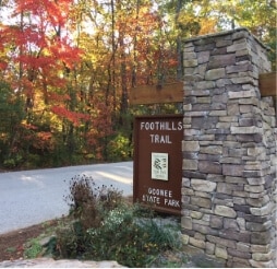
The Foothills Trail stretches from its western terminus in Oconee State Park (Oconee County, SC) and extends north for 77 miles to Table Rock State Park (Pickens County, SC).
In the fall of 2020, hiking enthusiast, Andrew Gleason, thru-hiked the entire Foothills Trail for the purpose of obtaining GPS locations along the way. He spent months compiling the data and created a user-friendly google map to help other hikers plan the best route for their journey.
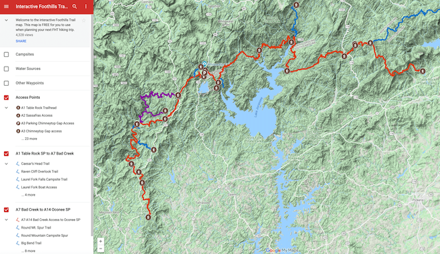
The fact that it’s “interactive” means users can select the features they want to see at various points along the trail including:
Bonus: It’s free! Thank you, Andrew Gleason ????
Read our comprehensive visitors guide for more details or sign up for our newsletter to stay up to date on things to do in Oconee County, SC.
Before you leave, subscribe to our newsletter with monthly events and happenings in Oconee County, South Carolina.
17 Responses
Thanks so much for sharing this!
Hi Andrew, thank you for the time and effort you put into creating the map!
Great Map Thank you
Robert, I’m glad this map is useful for you!
This is an amazing resource, thanks! Can I assume that campsites are “legal” and not on private property or otherwise in a “no camping” area? I just wanted to be sure. I’m hiking from Table Rock southwards and I know you can’t camp trailside within TRSP.
Wayne, I’m sorry for the delayed reply. I suggest contacting Foothill Trail Conservancy info@foothillstrail.org for specifics about camping.
Amazing!! So thorough and helpful, thank you!
Thanks for this great work. Is there anyway to get this in a KMZ file so it can be put in Google Earth? Thanks!
Hi Shawn. That’s a question for Andrew Gleason, he created the map. I believe you can find his contact on the Interactive Foothills Trail google map.
What a wonderful resources. Thank you Andrew for taking the painstaking hours to do this. So very much appreciated
This map help me so much during planning for the trip and on trail. Thank you!
Thank you so much, Andrew! This is a great help to planning our hike!
Is any of the data downloadable to put in Avenza or CalTopoi for use without a cell signal?
That’s a question for Andrew Gleason, he created the map. I believe you can find his contact on the Interactive Foothills Trail google map.
Is there a way to download the interactive Foothills Trail Map
Hi Mitchell,
I reached out to the map’s creator, and this is what he said: “No, the map files cannot be downloaded. Soon it will be available on the FarOut app and all proceeds go directly to the Foothills Trail Conservancy. The free version will still be online for people to plan their hikes. The FarOut app will have an exact copy of the interactive map and will work off line.”
Andrew Gleason
Foothills Trail Conservancy Chairman
The interactive map provided by Mr. Gleason is professionally done and quite useful. I plan to use this on my late April thru hike. I might add that this trail is also present on Gaia, but lacks the amenity and points of interest waypoints.