Most Popular

Search

Share

Belle’s Bistro

Located at Chattooga Belle Farm. Appetizers, soups, salads, specialty sandwiches and homemade desserts. HOURS: Wednesday – Sunday from 11am-2pm.

Share

Bull Sluice

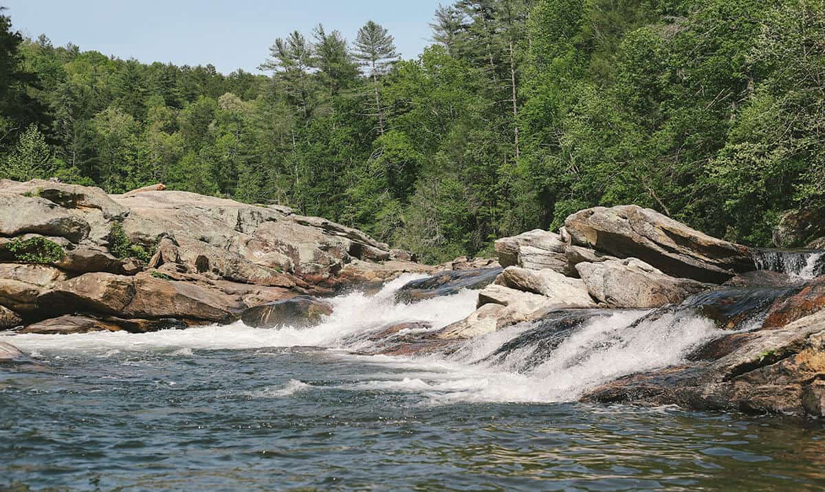
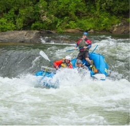
Bull Sluice is a Class Five rapid on Section III of the Chattooga River. This is a popular place to view rafting trips running the rapid. It’s a short .2 mile hike from the Hwy 76 Chattooga River Access parking lot. Follow the trail downhill to where it forks, and go right along the gravel trail to reach a viewing area. Depending on your mobility level, you can walk on huge rocks on the side of the river to get a better view. (The left fork takes you to a beach downstream of the rapid.)

Share

Carolina Pizza Company

Pizza, salads, sandwiches, beer. Open Wednesday – Sat 11:00 AM – 9:00 PM
picture of sunset at Chattooga Belle Farm

Share

Chattooga Belle Farm

Chattooga Belle Farm is a 200 acre working farm and event venue. The event barn is the ideal location for weddings, family reunions, and corporate retreats or any special occasion that calls for a setting like no other. Belle’s Bistro restaurant serves lunch. Farm Store sells food & gifts. On site Distillery makes small batch spirits.
photo of the Chattooga River in the winter

Share

Chattooga River

The Chattooga River is the boundary between GA & SC. It is nationally designated as Wild and Scenic and is protected from development. Known for whitewater rapids, and meandering, mountainous woodland passage. The lower sections of the Chattooga are considered among the best whitewater in the SE with heart-thumping Class III to Class VI rapids.

Share

Chattooga River – Section 3

Long Creek/Mountain Rest, SC
Get Directions >

Section 3 is a 13-mile beautiful stretch of river with intermediate to advanced whitewater. Its a 4-6 hour trip down river. Section 3 put-in is at Earls Ford, and the take-out is the Highway 76 Bridge. There is 1/4 mile hike in and out of the river. The Chattooga River is under the jurisdiction of the US Forest Service. There is a self-permit system (no fee), where you fill out a form, drop a copy at the box near the put-in and carry the other copy with you down the river.

Share

Chattooga River – Section 4

Section 4 is one of the most well-known sections of whitewater in the U.S. This 8-mile section includes major whitewater including Class IV-V rapids. It takes 4-5 hours to raft or paddle Section 4. Put-in at the Highway 76 Bridge, and take-out at Lake Tugalo. There is 1/4 mile hike to and from the river. The Chattooga River is under the jurisdiction of the US Forest Service. Anyone paddling on the river needs to fill out a permit (at the put-in) prior to getting on the river.

Share

Chau Ram County Park

Over three miles of hiking trails and a mile of the Chauga River runs through the park. Tubing, hiking, fishing, picnicking, camping and sight-seeing are popular activities. The park has 26 campsites with water and electricity; four rental areas for parties and gatherings; a playground; and is a favorite spot for weddings. $3 park entry fee.

Share

Devils Fork State Park

Travel Tip: ARRIVE EARLY! If you are coming to enjoy a day on the lake, make sure you arrive by 9:30AM for the best chance of getting a parking space. The park is the only public access point for Lake Jocassee, a 7,500-acre reservoir lake. Boat ramps for public boat access to the lake; 20 lakeside villas; 59 standard sites for RV or tent camping; 25 tent camping sites; 1 boat-in campground; 2 picnic shelters; 2 playgrounds; 2 mile Bear Cove Trail; 1 mile Oconee Bell Nature Trail. Park store.

Share

Foothills Trail

This National Recreation Trail has its southern terminus in Oconee State Park and extends to the north and east for 77 miles. Sections very in length and difficulty. Day-hikers can access the trail from different points; thru-hikers can spend a week backcountry hiking on the trail. Maintained by the Foothills Trail Conservancy.
picture of issaqueena falls

Share

Issaqueena Falls

Located in Stumphouse Park ($5 entry fee per vehicle). It’s an easy 5-minute walk to viewing platforms where you can view the beautiful waterfall named for a Creek maiden who hid on one of the falls’ ledges to avoid capture during an Indian attack. There is a rough trail next to the lowest platform, which leads to the base of the falls. However, the PATH IS QUITE DANGEROUS and visitors are not encouraged to try it. GPS coordinates to the parking area: N 34.80740 W 083.12158

Share

Jocassee Lake Tours

Love Nature? Treat yourself to an exploration of Lake Jocassee with Brooks and Kay Wade, Upstate Master Naturalists and owners/operators of Jocassee Lake Tours. Love Waterfalls? Bring a camera…they have plenty to show you! From hidden mountain brooks spilling off the hillside to large, rambunctious, powerful waterfalls. Love Your Friends and Family? Treat them to a tour of Lake Jocassee. Bring a picnic lunch, kids and grandkids, and experience a relaxing day on Lake Jocassee!

Sign up to know what’s going on in our towns!

Before you leave, subscribe to our newsletter with monthly events and happenings in Oconee County, South Carolina.

Name